
This webpage is for archival purposes only. It is no longer being maintained. Please see our new website at http://lib.berkeley.edu/EART
 |
 |
 |
 |


Historical Maps
Geologic Maps
Land Use Maps
Demographic Maps
Cartography
Historical Maps
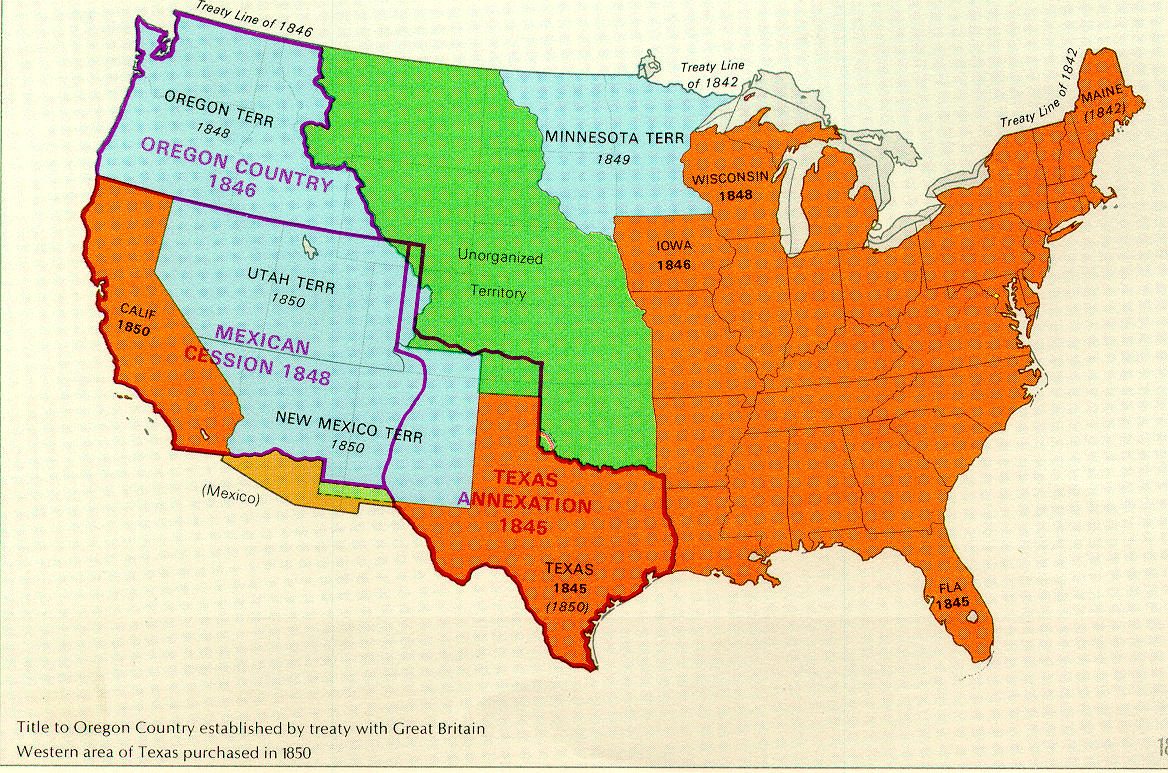 There are many historical maps in the collection. This one shows U.S. territories for the period 1850. (G1200.U6 1970 no.192 Case D) |
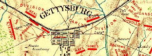 Other historical maps and atlases deal with specific events, such as wars and battles. This example shows the Gettysburg Battlefield, with troop positions as of July 2nd, 1863. |
Geologic Maps
The Earth Sciences & Map Library collects geologic maps for various areas of the world. Currently all maps produced by the U.S. Geological Survey, and all geologic maps produced by the various State Surveys are collected. Foreign geologic maps are received as exchange items or are purchased selectively.
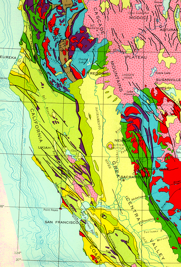
Portion of Northern California
(Call No. G4361.C5 1966 .C3 Case B)
Land Use Maps
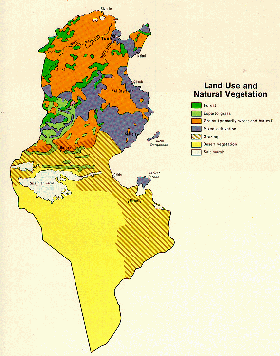 Tunisia Land Use and Natural Vegetation C.I.A., 1972 (Call No. GG8250 1972 .U5 Case D) |
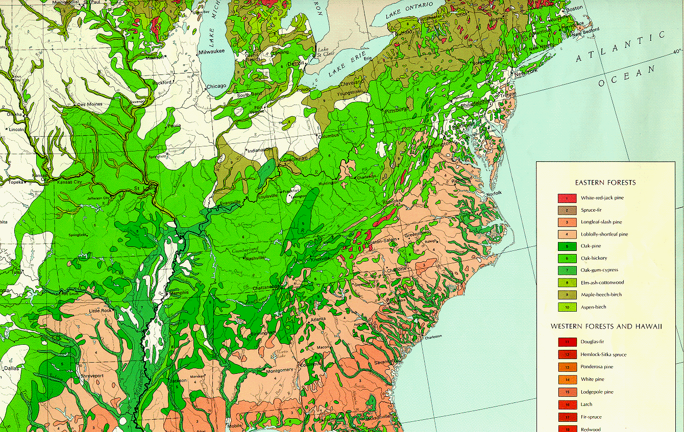 Major Forest Types National Atlas of the United States, 1987 (Call No. G3701.K2 1987 .G4 Case D) |
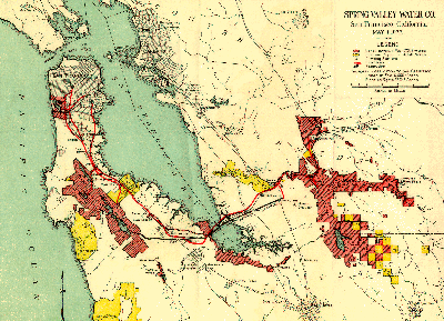
Spring Valley Water Co., San Francisco, California, 1922
(Call No. G4362.S22N44
1922 .S7 Case D)
Demographic Maps
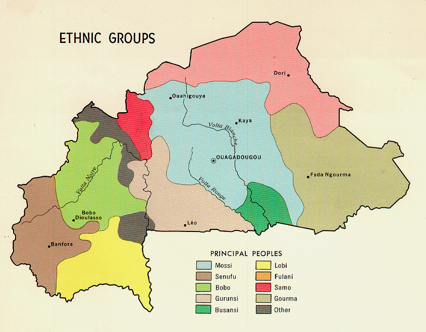
Burkina Faso Ethnic Groups / C.I.A. 1968
(Call No. G8805 1968 .U5 Case D)
Cartography
The Earth Sciences & Map Library also collects maps (and text materials) that demonstrate various map projections, grid and coordinate systems, global positioning systems, geodetic control, triangulation, and other elements related to surveying and photogrammetry. The example below shows some aspects of the Mercator projection.
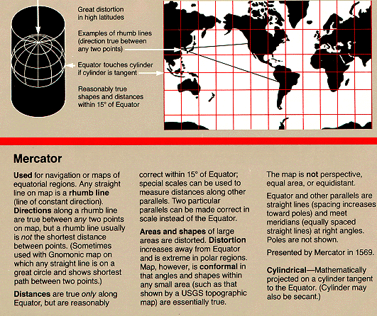
(Call No. G3201.B72 1993 .G4 Case B)
 Return to Digital Tour of the Library's Map Collection
![[ HELP/FAQ ]](/Images/helpgr.gif)
![[ CATALOGS ]](/Images/catalogsgr.gif)
![[ COMMENTS ]](/Images/commentsgr.gif)
![[ HOME ]](/Images/homegr.gif)