
USDA, Agricultural Adjustment Administration
Flight Symbol DDB
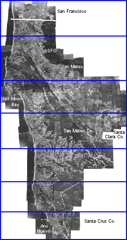
Click on section for enlargement
Scanning provided by Stanford University's Branner Earth Sciences Library & Map Collections
 Return to Online Flight Index
 Return to Earth Sciences & Map Library's Homepage
![[ HELP/FAQ ]](http://www.lib.berkeley.edu/Images/helpwh.gif)
![[ CATALOGS ]](http://www.lib.berkeley.edu/Images/catalogswh.gif)
![[ COMMENTS ]](http://www.lib.berkeley.edu/Images/commentswh.gif)
![[ HOME ]](http://www.lib.berkeley.edu/Images/homewh.gif)