


| Flown by | U.S. Forest Service |
| Date Flown | 1944 |
| Scale of originals | 1:20,000 |
| Flight Symbol | DDE |
| Stereo Overlap | Yes |
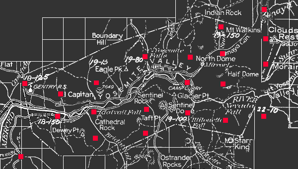
Partial Coverage of Flight
Click on red dots (photo centerpoints) to view aerial photographs
 Return to Earth
Sciences & Map Library's Home Page
Return to Earth
Sciences & Map Library's Home Page![[ HELP/FAQ ]](http://www.lib.berkeley.edu/Images/help.gif)
![[ CATALOGS ]](http://www.lib.berkeley.edu/Images/catalogs.gif)
![[ COMMENTS ]](http://www.lib.berkeley.edu/Images/comments.gif)
![[ HOME ]](http://www.lib.berkeley.edu/Images/home.gif)